
Climate Resilience & Coastal Adaptation
Start of page content
While the Climate Action Plan (CAP) is largely focused on mitigating and reducing the future impacts of climate change, some effects are already beginning to take shape. The CAP’s Climate Change Vulnerability Risk and Adaptation Assessment Chapter outlines the current and future impacts of climate change. The CAP outlines strategies for the City to improve community resilience and adaptation to the current and future impacts of climate change.
Resilience & Adaptation
Climate Resilience
The CAP calls for adapting to an increase in global average temperatures. The CAP’s Carbon Sequestration Strategy sets goals for City tree planting which is an effective way to prepare for a rise in temperatures by reducing the urban heat island effect. The urban heat island effect is a phenomenon where higher temperatures are experienced by urban areas as a result of fewer trees and more manmade surfaces that absorb heat. Trees help reduce the urban heat island effect by shading heat-absorbing surfaces. Since 2012, the City has planted 1,226 net new trees in the City’s streets and parks, advancing community heat resiliency in the process.
Additionally, a future decrease in precipitation is expected as a result of a changing climate. The CAP’s Water Efficiency Strategy seeks to reduce the amount of water consumed by Encinitans to prepare for a potential decrease in water availability. Studies have shown that increased water rates can lead to decreased water consumption. The City’s Bee City USA affiliation since 2023 and development of a Native Plant Ordinance in 2025 will both help to promote the planting of native vegetation, which requires less water than traditional ornamental landscaping.
Another expected climate impact that the City’s CAP prioritizes is the increased likelihood of wildfire. Several areas in Encinitas are particularly vulnerable to wildfire risk and climate change is expected to increase the frequency of wildfires. Thus, the CAP seeks to increase preparedness for future wildfires. The Encinitas Fire Department, in close partnership with the County of San Diego, conducts outreach and education for residents to be more prepared for procedures in the event of a wildfire. The City also operates a Fire Prevention Bureau which oversees business inspection and weed abatement programs and enforces hazardous materials storage/use and disposal laws.
Resilience & Adaptation
Fire Resilience
The Encinitas Fire Department has six fire stations strategically located in different areas of the city to provide “around-the-clock” coverage to the community. As of 2025, the Fire Department includes 55 personnel, four engines, one truck, one Type 6 wildland truck and various other emergency apparatuses needed for specialized responses. Fire Station 6 is located in Olivenhain, the easternmost community in the City, and has two fire personnel assigned to the station per shift. This station was added to the Olivenhain community approximately 10 years ago on a temporary basis. Given that Olivenhain is located in the Very High Fire Hazard Severity Zone, the City continues to investigate potential locations and associated costs for establishing a permanent site for Fire Station 6.
In June 2025, the City of Encinitas adopted Ordinance No. 2025-07 to update the City’s Fire Hazard Severity Zone maps designating moderate, high and very high hazard areas as determined by the California Department of Forestry and Fire Protection. The designation of these zones is necessary for public safety and the protection of life, property and natural resources from wildfire. Residents can use the Encinitas Fire Hazard Severity Zone Map to view fire severity zones within Encinitas.
In December 2025, the City adopted targeted local fire-safety and wildfire-resilience code updates through Ordinance No. 2025-21 and related actions to amend state fire codes to better address local conditions and community needs. Ordinance 2025-21 updates three chapters of the Encinitas Municipal Code, refining the City’s Fire and Wildland-Urban Interface (WUI) standards to align with the 2025 California Fire Code and 2025 California WUI Code while incorporating locally appropriate modifications. Key changes include refined fire apparatus access requirements that establish specific widths, grades, turnarounds and turnouts to improve fire response and evacuation reliability.
Resilience & Adaptation
Sand Compatibility and Opportunistic Use Program
SCOUP is part of a regional sediment management plan intended to streamline beach nourishment projects. The standardized permitting process facilitates the use of available sand from construction sites and other opportunistic sources. The program includes stringent environmental regulations to ensure that the sand sources are compatible with receiver sites. The timing and location of sand placement are also strictly controlled to reduce any negative impacts on coastal habitats and recreation.
In 2025, the City finalized two SCOUP permits, one for the Batiquitos Double-Track Project to place sand at the northernmost portion of our City’s coast and the 2025 Greystar Assisted Care Facility SCOUP Project, to place sand at Leucadia State Beach, which extends from north Beacons Beach to just south of Grandview Beach. Past SCOUP projects include: 2021-2022 Caltrans Work Berm at San Elijo Lagoon SCOUP Project, in which sand was placed at Cardiff State Beach and Moonlight Beach, and 2019 Encinitas Beach Resort SCOUP Project, in which sand was placed at South Ponto Beach/Batiquitos State Beach area.
The City of Encinitas has used beach nourishment for many years as a method of building coastal resilience, addressing coastal erosion and making beaches safer and wider for residents and visitors.
Resilience & Adaptation
Coastal Storm Damage Reduction Project
The US Army Corps of Engineers Coastal Storm Damage Reduction Project, federally known as the San Diego County, CA Project, is another long-ranged coastal adaptation effort in Encinitas, which includes the periodic construction of protective beach berms along two segments of shoreline within San Diego County, California using sand from offshore borrow sites. In 2025, this project received national recognition as the “Best Restored Beach” through the American Shores and Beach Preservation Association awards program.
Segment 1 of the project is located in Encinitas and extends approximately north of Swami’s to south of Beacons Beach for 7,800 feet. Along this stretch of shoreline, a fifty-foot-wide protective beach berm was constructed in 2024 using approximately 340,000 cubic yards of compatible sediment from an offshore borrow site. Renourishment of Segment 1 is scheduled to occur every five years with approximately 220,000 cubic yards of compatible sediment over a Federally approved 50-year period.
Segment 2 of the project is located in Solana Beach and extends from Fletcher Cove to just north of the City of Del Mar limits for 7,800 feet. Within Segment 2, a 150-foot-wide beach berm was constructed in 2024 using approximately 700,000 cubic yards of compatible sediment. Renourishment of Segment 2 is scheduled to occur every 10 years using approximately 290,000 cubic yards of compatible sediment, over a Federally approved 50-year period.
The purpose of this project is to minimize the energy of storm surge hitting the bluff face. The newly created wide, sandy beach now dissipates wave energy before contact with the bluff, reducing potential erosion. In addition to shoreline protection, this project has enhanced public safety, providing wider and safer beaches for recreation. Another important co-benefit includes environmental enhancement and restoration of habitat for birds, fish and invertebrate species.
Resilience & Adaptation
Swami’s State Marine Conservation Area and Marine Monitoring
Marine Protected Areas (MPAs) are geographic marine or estuarine areas that have been designated by law or administrative action to protect marine life and habitat. MPAs have been scientifically proven to promote the restoration of ecosystems and increase biodiversity, which supports the ocean’s resilience to pollution and climate change. The City of Encinitas is home to three MPAs, including the Swami’s State Marine Conservation Area (SMCA), San Elijo Lagoon SMCA and Ecological Reserve, and Batiquitos Lagoon SMCA and Ecological Reserve.
To support the regulation of activity in the Swami’s SMCA, the City installed a marine monitoring (M2) radar in November 2020 on top of the Marine Safety Center at Moonlight State Beach, in partnership with Protected Seas, the designers of the radar program, and WILDCOAST, an international environmental nonprofit organization. M2 is a low-powered, high frequency marine radar coupled with software designed to track boat activity and illegal fishing in nearshore waters. M2 monitoring is ongoing and has provided data that is critical to both management and enforcement of fishing restrictions in the Swami’s SMCA.
Resilience & Adaptation
Cardiff State Beach Living Shoreline Project
The Cardiff State Beach Living Shoreline Project was completed in 2019 and restored a historic dune system on top of buried engineered rock revetment, cobblestone and approximately 30,000 cubic yards of compatible sand. The project created 2,900 foot long and 30-foot-wide dune along a low-lying section of Cardiff shoreline. To establish coastal habitat, native seeds and potted specimens of dune-thriving plants were installed along the easterly length of the project.
The Cardiff State Beach Living Shoreline Project is the first of its kind in Southern California to test coastal dunes as a nature-based solution to beach erosion and coastal flood protection. The project created healthy and safe habitat for a variety of species, including the endangered western snowy plover. Additionally, a five-foot-wide, decomposed granite footpath was installed east of the dune system to support pedestrian activity along South Coast Highway 101. In 2019, a monitoring program was developed to study the Cardiff State Beach Living Shoreline Project and to inform other coastal communities considering similar adaptive measures. Monitoring data is also used to inform the project’s long-term maintenance. The project is a collaborative effort between the City, California State Parks, California State Coastal Conservancy, the Nature Collective, U.S. Fish and Wildlife, Surfrider Foundation, University of California Los Angeles (UCLA) and Scripps Institution of Oceanography.
Over the past several winters, significant storm and wave events showcased the effectiveness of the Cardiff State Beach Living Shoreline Project to protect the coastline from flooding and erosion. Without the existence of this structure, there would almost certainly have been significant flooding and undermining of South Coast Highway 101 that would have required extensive and very expensive repairs. During large storms, by design, the westerly face of the dune system is sacrificially eroded by storm surge and wave action. After winter storms, the project is routinely maintained, utilizing the sand from the San Elijo Lagoon inlet to building back the westerly face of the dune.
Resilience & Adaptation
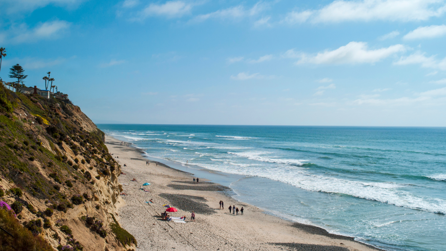
Beacon’s Coastal Bluff Restoration Project
The Beacon’s Beach Coastal Bluff Landscape Restoration project was installed in 2021 to stabilize an eroding coastal bluff using native vegetation and protect the access trail at this popular beach destination. The 1.2-acre coastal bluff area largely contained non-native species or bare ground before the project. The project’s restoration plan includes testing the use of washed-up kelp to enhance natural dune formation. Long-term monitoring plans include citizen science opportunities to increase engagement and stewardship in the community. The City’s Parks and Recreation Department continues to manage this ongoing project by reseeding the bluff every spring.